

Sedamsville and East Price Hill: "Close to the City, yet so far away"
- Anthony Gustely

- Sep 20, 2020
- 5 min read
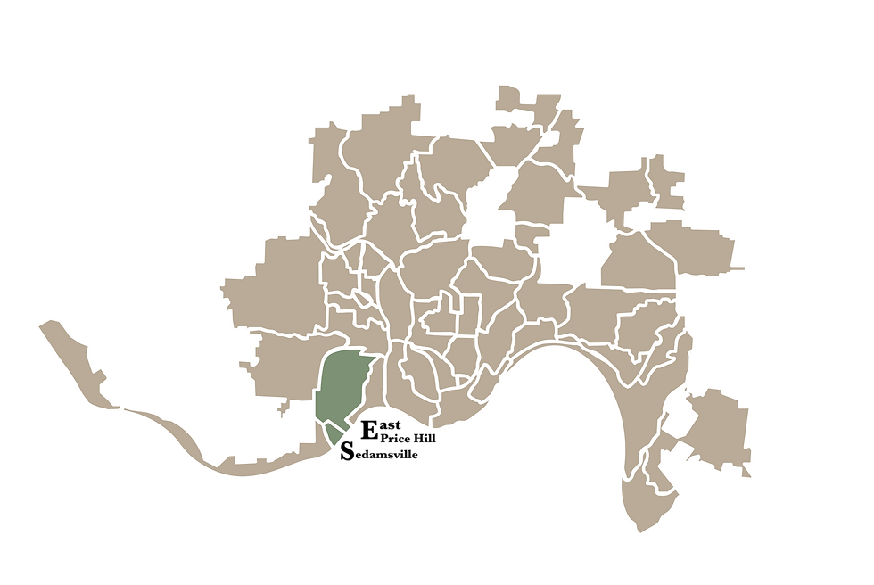
It's week three of 52 First Impressions, and I'm visiting neighborhoods 5 and 6 of 52: Sedamsville and East Price Hill. Fortunately, I didn't scare off my friend Nicole on our week 1 visit to Sayler Park and Riverside, so she's back again for another round! While the East Price Hill is more well-known as a part of the Price Hill area, Sedamsville has an interesting history with tidbits you'll be interested to learn about. Let's get into it.
Sedamsville
Located just three miles west of downtown Cincinnati (yes, we're getting closer and closer to downtown!), Sedamsville was settled in 1795 by Revolutionary War veteran Colonel Cornelius Sedam (learn more here). Originally buried on a plot within the neighborhood after his death in 1823, Col. Sedam's body was later moved to the Spring Grove Cemetery (which I'm visiting in a few weeks).
I'm going to assume -- even of you native Cincinnatians - that you probably have never even heard of Sedamsville. Why? Because the neighborhood was wiped out by the great flood of 1937. Unlike its western neighbors of Riverside and Sayler Park which lie mostly on a higher elevation, Sedamsville's homes and few businesses abut River Road (which runs along the Ohio River). This elevation difference and location of core businesses is the reason the neighobrhood was so disproportionately affected by the flood. In combination with the widening of River Road in the 1940s. the neighborhood's business district was almost completely wiped out. Many families were displaced, and the neighborhood no longer had a bustling commercial base.

Sitting at just under a quarter mile in total land area, Sedamsville still has its claims to fame. The neighborhood is the birthplace of Cincinnati Red's baseball icon Pete Rose. The Sedamsville Rectory, one of four buildings of the now closed Our Lady of Perpetual Help Church, is now coined as one of the most haunted places in America. The Church was opened in 1878 by the large German Catholic population that settled in Sedamsville. With a similar fate to many other businesses in the neighborhood (for reasons earlier mentioned), the Church closed in 1989. Many visitors to the rectory have reported strange breezes, weird vibes, and even physical harm while in the building. The building itself is eerie and vacant, with two expensive-looking tall polished doors in the center. Nicole and I took some pictures outside, but we were too afraid to schedule a ghost visit.

Making our way back towards US-50, Nicole and I stopped at Boldface Park. Named after a Miami chief by the name of Chief Boldface, the park's core feature is an old stone structure with 11 arches that overlooks a retention ditch. Boldface Park is modest in comparison to other Cincinnati Parks, however its view from the structure provides a glimpse into Sedamsville's past. Looking across the street towards one of Sedamsville's commercial areas, Nicole and I saw a patchwork of older buildings and empty plots. We could only assume that the street we saw had once been lined with shops and homes. The hotchpotch of buildings is a physical reminder of the flood that altered the course of Sedamsville's history forever.


Today, Sedamsville has a population of 680 and is the 48th largest neighborhood within the City.

East Price Hill
A part of a thriving legacy, East Price Hill was part of an area settled in the early 1800s by industrious famers and merchants. The western hills and Mill Creek served as a topographical barrier between the affluence of Price Hill and poorer, blue-collar residents below. East Price Hill's claim to fame is in providing the link between downtown Cincinnati and Price Hill in the late 1800s. The Price Hill Incline opened in 1874, linking commuters and new businesses to Price Hill. Combined with the construction of the Western Hills Viaduct, Price Hill slowly became the new "it" place to settle down near the City.
Founded on the Price family's values of hard work, family, and religion, Church is a focal point of the community. Nicole and I learned this lesson the hard way by visiting on the Lord's day, as most family businesses in Price Hill are closed on Sundays. We had planned on stopping at St. Lawrence Bakery to grab a treat, but snagged this beautiful picture of St. Lawrence Church: the first church founded in Price Hill (1868!).

Nicole and I ventured towards the Incline District next. Resting on the western section of the old Price Hill Incline, the former transit hub of the West Side, the district is now a walkable area with shops, restaurants, a community theater, and apartments with a myriad of architectural styles including Italianate, Queen Anne, Colonial, and others.
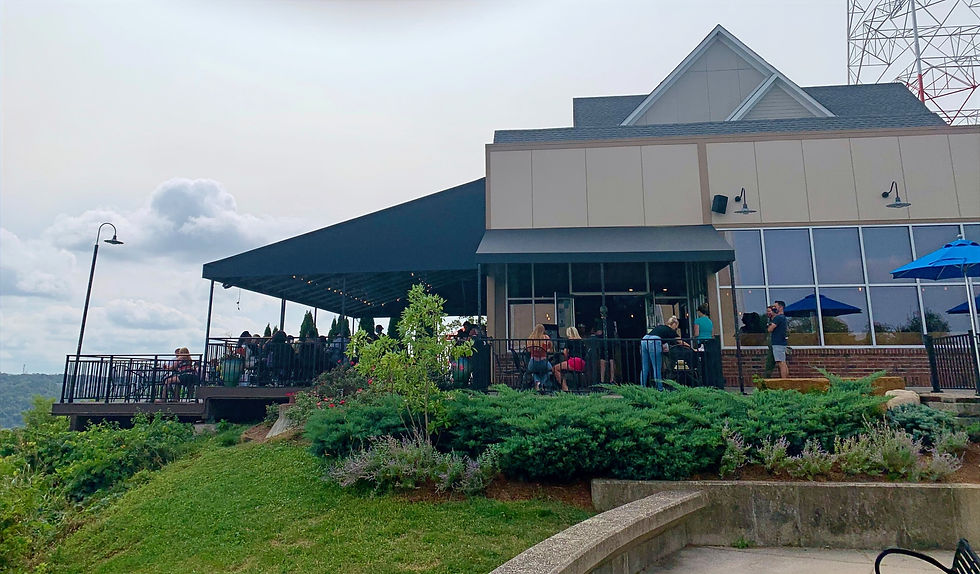
Nearing lunchtime, Nicole and I decided to grab a bite at the Incline Public House. The Price family originally opened the Price Hill House to provide commuters using the Incline with a restaurant close to the Incline. Although the restaurant was closed in 1930, the Incline Public House is still taking advantage of the incredible view from the top of the western hills. I ordered the spicy chicken with serrano-corn pancakes and Nicole ordered a black bean burger. Both meals were amazing, and I'm bummed because I didn't snap a pic.
Our final stop in East Price Hill was Mt. Echo Park. Opened in 1908, the Park sits on the land of a former dairy farm. Its crowned jewels are its Italianate-style pavilion completed in 1928 and its mesmerizing views of Downtown Cincinnati. 84 acres in size, Mt. Echo park is clean and beautiful with hundreds of different tree and plant species to see. The historic pavilion was incredibly beautiful and would be an amazing spot for a private event like a wedding!


"With its schools and churches, its corner stores and offices, its wide streets and big yards, East Price Hill feels like a small town. Yet it is also 'of the city', just a few minutes from Downtown where many of its residents work. It is a stable community, where most people live out their entire life under the shadow of one church spire, in the house their parents lived in. If someone moves, they never go too far away -- maybe just around the corner, still close enough to the family's kitchen table." - poster, Mt. Echo Park


Sedamsville and East Price Hill are two streetcar suburbs of Cincinnati that have epitomized the positive and negative impacts of expanding transportation infrastructure. The widening of River Road rolled directly through the heart of Sedamsville, displacing residents and turning Sedamsville into a pass-through neighborhood. On the flip side, Price Hill became even more vibrant and populated through the Price Hill Incline, transcending magnanimous geographical barriers that once inhibited settlement in the community. The lasting impacts of the construction of transit systems in Cincinnati is close to the hearts of many Cincinnati neighborhood histories.
Thanks for reading, and feel free to subscribe to my blog for post notifications! Join me next week as I visit North and South Fairmount. See you then :)


Comments